The following attributes can be passed height= 600 sets the height of the map div width= 800 sets the width of the div.
In this case the label can include any text including HTML, should you wish to include links or other formatting. centre= 54.454198, -3.211527 sets the centre point, to override the centre or if not using markers or track files..
Scale uses OS scale values which are essentially multipliers on 1 10000 scale, so 5 represents 1 50000 and 100 represents 1M. The available scale values are 1, 2, 2.5, 4, 5, 10, 20, 50, 100, 200, 500, 1000, 2500.
To upload KML or GPX file just use the WordPress uploader and then copy the address of the uploaded file into the shortcode..
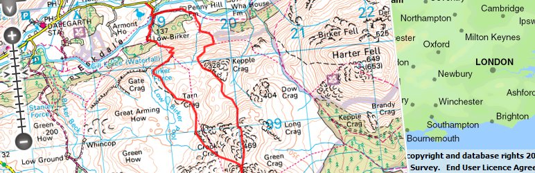
Examples displays 300px by 300px window containing blue track from the file specified.. shows default size and zoom window with marker placed and the text.
Go to the Plugins page in the area, search for openspace navigate to the plugin page and click install..
Before the plugin will work you need to add your API key to the settings page on the dashboard..
If you are running WordPress Multisite you will have to add KML and GPX files to the allowed file types under 'Network Settings if you wish to upload these files...
After picking up few clues on OS Openmaps forums, I made couple of simple tweaks to the in the folder and fixed it.
Browse the code, check out SVN repository, or subscribe to the development log by RSS... 1.3.1.
Read more
Related items: